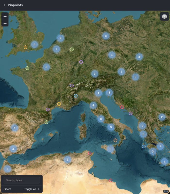
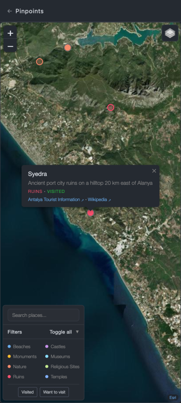
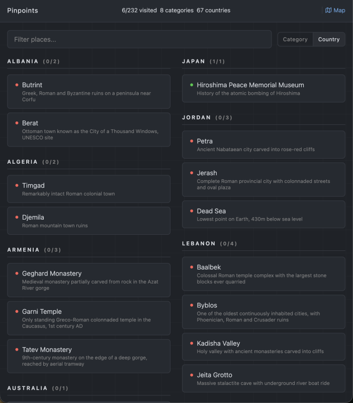
Interactive map for plotting and browsing travel destinations.
- Index view with places grouped by category or country
- Interactive map with all pins, marker clustering for dense areas
- Category-based color coding with toggleable legend
- Visited / want-to-visit status filtering
- Click a place card to focus it on the map
- Dark theme, responsive design
places.json         # array of places (name, lat, lon, category, country, visited, note)
index.html          # the app
favicon.svg         # map pin icon
Edit places.json and add an entry:
{
  "name": "Place Name",
  "lat": 41.89,
  "lon": 12.49,
  "category": "ruins",
  "country": "Italy",
  "visited": false,
  "note": "Optional description",
  "sources": ["https://example.com/place"],
  "local_name": "Optional local name"
}
Categories are free-form strings. Colors are auto-assigned from a fixed palette. Sources and local_name are optional. Sources can contain multiple URLs, shown as clickable links in map popups.
Static site. No build step, no dependencies.
python3 -m http.server 8080- Leaflet (BSD-2-Clause)
- Leaflet.markercluster (MIT)
Tile providers:
- OpenTopoMap - CC-BY-SA
- CyclOSM - ODbL (OpenStreetMap)
- Esri World Imagery - Esri
- CARTO - CC-BY 3.0
- OpenStreetMap - ODbL
places.json is excluded from this repository. To use this app, create your own places.json with an array of place objects (see "Adding a place" above).
- GPX Trails - interactive GPX route viewer with elevation profiles and route stats